Florida Hurricane Survival Guide For Newbies
By Loretta Cochran
Introduction
How We Got Here from There
It seems everyone in Florida is from somewhere else, so I thought I'd begin by telling you how and why we moved 3200 miles to sit right smack dab in the center of Hurricane Land.
My husband and I moved to lovely Bradenton, Florida from Vancouver, Washington in May of 2002. Also known as “the other Vancouver,” our former haunt is a small suburb of Portland, Oregon, a mid-sized city much like Tampa, which lies just across the Columbia River. The area boasts an average of 32 clear days a year, which the tourist guidebooks will tell you is perfect weather for the Redwood Rainforest. It is also good weather for ducks—not
the Ducks, but real ducks, which should not be confused with the University of Oregon’s football team as real ducks are much tougher and have nicer uniforms.
In that climate, water falls on one’s head for an average of 333 days per year, except at those magical times when the Arctic winds shift from northerly to northeasterly and come screaming out of the Columbia Gorge with the force of the Furies themselves. This effectively transforms otherwise miserably cold raindrops to freezing shards of glasslike water propelled at one’s face at a perpendicular angle by 40-mile per hour shrieking winds. Locally, this is called “freezing rain.” You can simply think of it as sleet on steroids; it pierces the skin with the efficiency of a disgruntled acupuncturist and makes you yearn for a gentler climes. Like Alaska.
During one such bout with what Northeasterners would call a “real” winter, the novelty thermometer on our patio read “pretty cold” then “really cold” then “freaking cold” and finally “how can you
[expletive deleted] live here?” It was without a doubt the best question ever asked by an inanimate object. Jim and I were certainly stumped.
So, with grand plans to live as paupers in paradise, we left behind highways that resembled skating rinks, skies that never cleared and incomes in the upper tier of the upper middle class. We packed up our most valued possessions, our permafrost toes, perpetually runny noses and ran, seeking sun, sand, palm trees and subsistence wages in Sunny Florida. We were not disappointed on any of the above, particularly the latter. It seemed as if our strategy was playing out beautifully. For the first two summers, life seemed idyllic despite our depression that the going wages in our fields of work were one-third to one-half of what they were out west. The quality of our lives had improved so much that it scarcely mattered. Every weekend seemed like a vacation, so who needed money? Who needed to get away from it all? Get away from what? White sand beaches? Dreamy turquoise water? A close-knit community unlike any we’d ever known and into which we were almost immediately accepted?
We swam in the ocean nearly every day. On our first 4th of July, we encountered a manatee in the warm Gulf waters. I learned to snorkel. Jim caught a black tip shark on his first fishing trip. I fished in saltwater for the first time. My first catch was a toadfish. I don't know if you've ever seen one, but it is one of the absolutely ugliest creatures on the planet and when I pulled it out of the water I screamed like I'd pulled up the devil itself, which by all logic it seemed that I had. But I still loved my new home.
We watched the “Tropical Updates” on the local news station with only casual interest. After all, the Northwest was famous for its erupting volcanoes, sudden and violent earthquakes, mudslides and ice storms that shut down power grids and entire cities for days on end. We’d both breezed through several six-plus magnitude earthquakes. I had personally witnessed the second large eruption of Mt. St. Helens from a distance of less than forty miles and somehow lived through the ash fallout. We were coming from an extremely harsh climate and were no strangers to natural disasters; we were foolishly brave. That is, until 2004 when it seemed every hurricane had its eye on Florida.
It wasn’t as if we were unaware of the danger of hurricanes when we chose Florida. Who could forget the widely reported devastation of Andrew? We didn’t live in a cave, contrary to some East Coast perceptions of Pacific Northwesterners, a perception that envisions us as raised-by-wolves, animal skin-clad hunters and gatherers with highly developed canine teeth perfect for ripping flesh from the bones of our kill. Though it is at times helpful to perpetuate this stereotype, for example, when arriving in the checkout line at the Winn-Dixie, it’s not even remotely accurate. We had cable TV and indoor plumbing and everything. We were as versed as any American in national and world events. (Okay, that’s not saying much. I’ll give you that.)
The horrific things we
didn’t know about when we moved to Florida include astonishingly prolific lightning storms, palmetto bugs (roaches, just bigger and crunchier when you step on them), the voracious appetites of unseen noseeums, mosquitoes the size of SUVs, poisonous snakes, fire ants, red tide, filthy Florida politics and the fact that no-name storms can be as lethal as quaintly monikered hurricanes. But those surprises are topics for my next books:
Florida Outdoor Survival Guide for Newbies: Fun With Deet and
Florida Political Survival Guide for Newbies: Come On…You Didn’t Really
Think Your Vote Would Be Counted.
But I digress.
We moved here with the intent to live and work here, and to become as much a part of our community as we were in Vancouver, which is to say we expected to carry with us the tradition of a morning nod in the direction of our neighbors whose names we didn’t know and at whose noisy children we routinely directed mumbled curses. Little did we know that we’d settle in a community just outside Florida’s last remaining fishing village and form profound bonds with people we’d known for mere months—even before the dastardly hurricane season of 2004 when it seemed at times that we all needed each other more than we needed oxygen.
A hurricane bearing down on your neighborhood schools you in both the value of and your responsibility to your community in an instant. And that’s what the first hurricane of the season, Charley, did for us when we turned on the Tropical Update and saw that line up the center of the "cone of probability" (kind of like the cone of silence, but less effective.) That line was overlaid right on top of our precious newfound community. That scary black line in the center of the cone passed right through our neighborhood. Right through our house. Right through everything that had made us so very happy for the previous two years. And we had no idea what we were supposed to do.
Next up: Chapter One: Two Rules
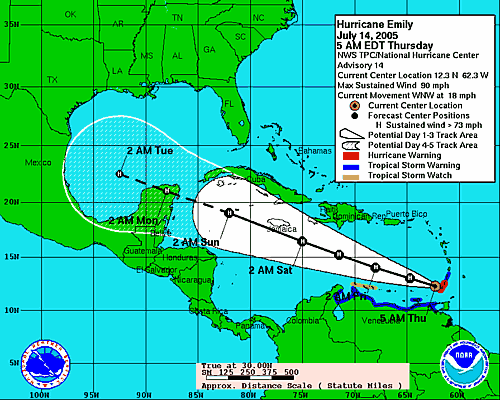
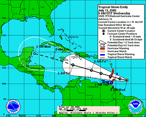
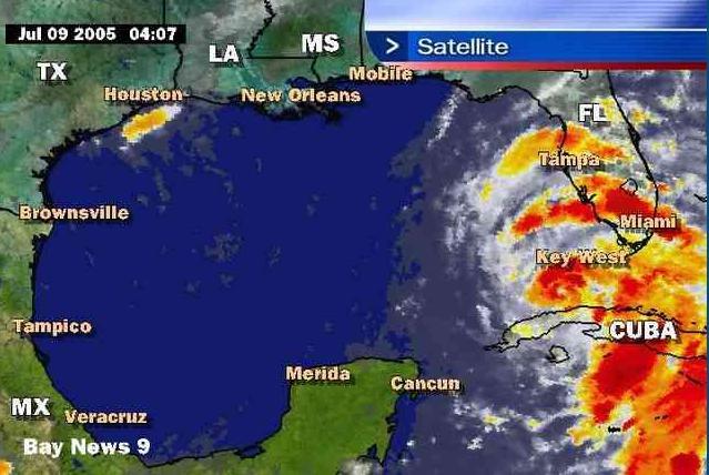
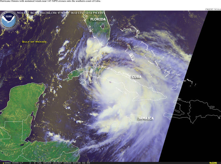
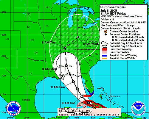
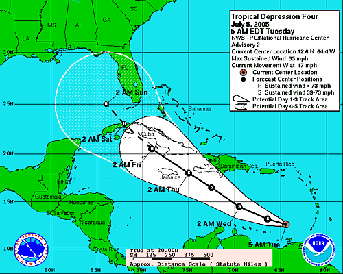
 Courtesy NOAA
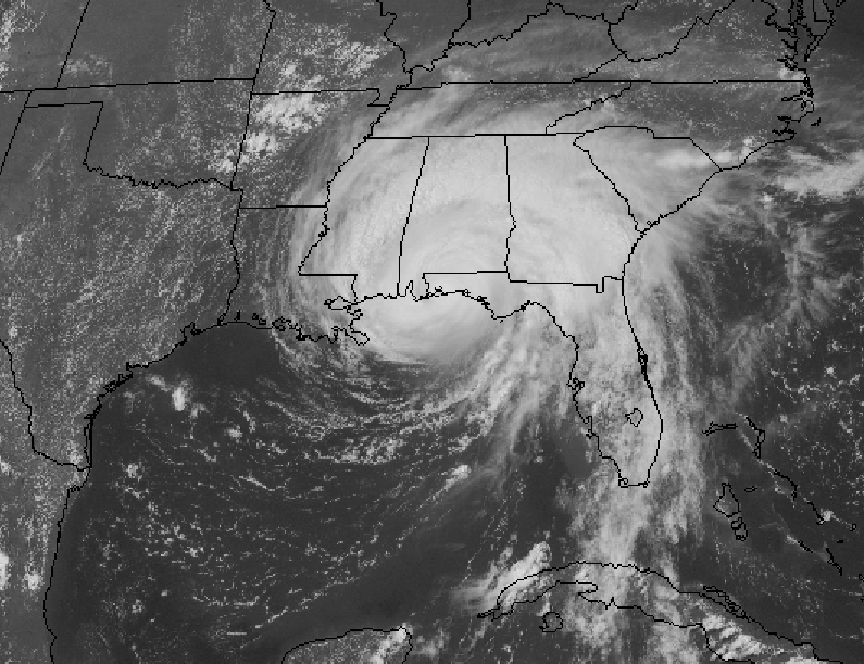
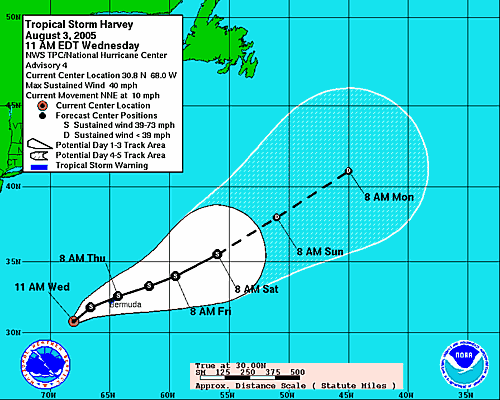 Meanwhile, Tropical Storm Harvey has arrived. As of a mid-afternoon advisory, Harvey is much stronger than originally believed.


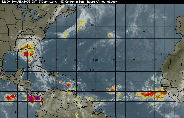


 Tropical Storm Matthew is no threat to Florida. We'll get some rain, which we don't need, but we won't be boarding and hoarding this weekend.