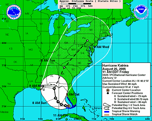
Katrina is giving the weather computers fits. The
NHC discussion this morning indicated that none of the models have been able to track Katrina accurately. The current track is a blend of models, but since none have been able to forecast its motion accurately...all bets are off as far as I'm concerned. Not that I think it will hook east like Charley did last year, but who knows? The trouble with 'canes is they simply don't listen to weather forecasters.
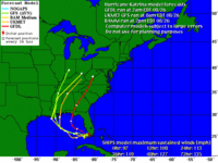
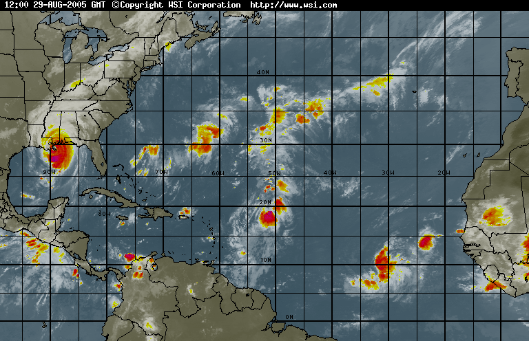
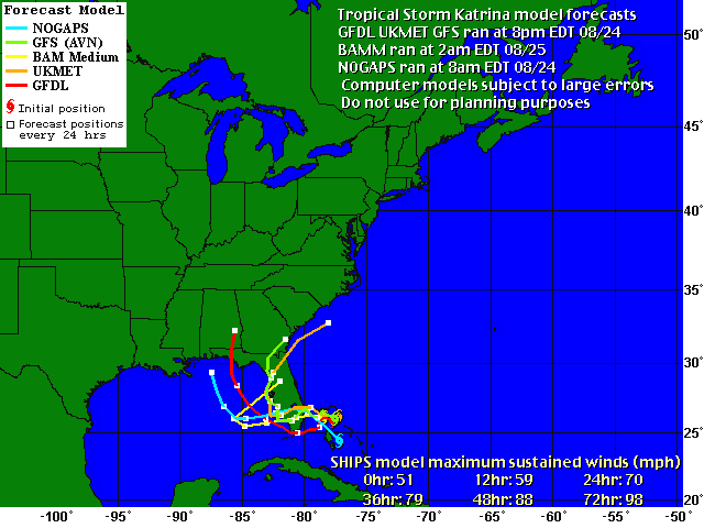
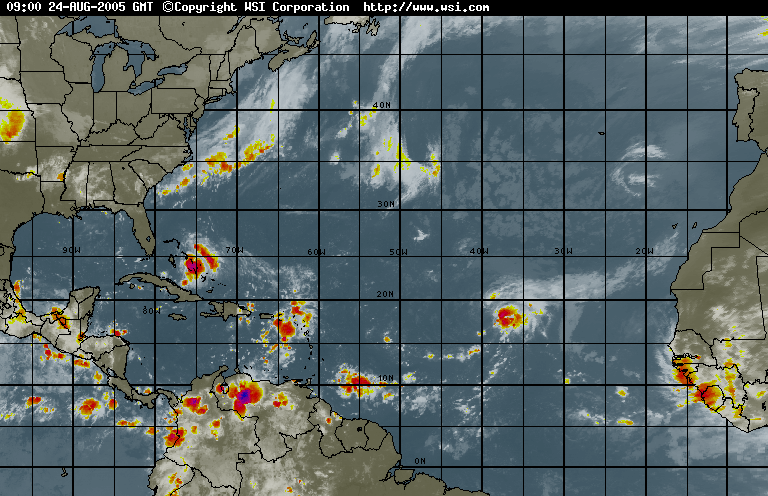
The computer models have shifted all over the dang map for the last couple of days. It's hard to have confidence in any of them. Note in this view from
Weather Underground that three of the current models track Katrina further west, while one pulls it farther east. One thing is certain: Katrina's movement depends on a ridge of high pressure currently over Texas. When it encounters a weakness in that system, it will turn west. It seems that no computer or human can predict when or where that will happen. Welcome to the wonderful world of hurricane forecasting. What a job. When I don't do my job, someone doesn't get their
fart machine in time for Christmas. But no one dies for lack of a fart machine. Well, maybe your old uncle who insists on playing the "pull my finger" game at the dinner table, but he's probably an old fart who's time has come anyway. [Kidding...don't send me hate mail, please.]
I heard from our friend Phil up in the panhandle this morning. Here's what he had to say:
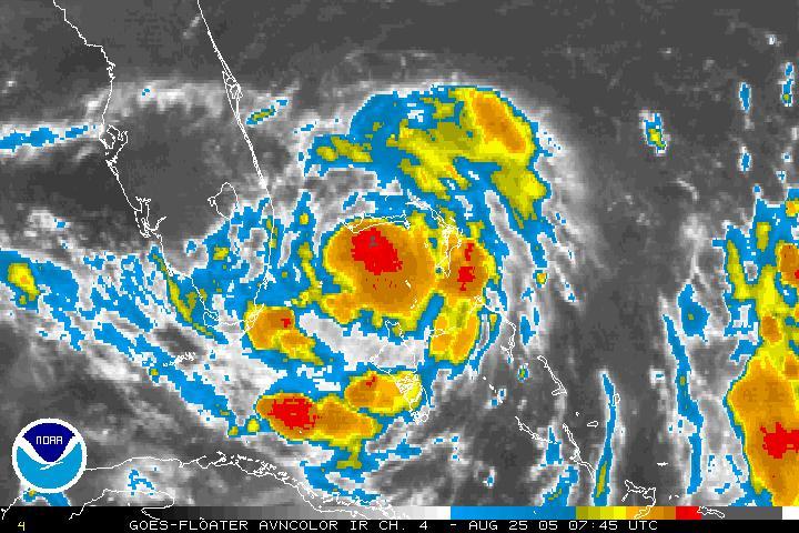
Hello and good mornin' guys... I smell a hurricane. Looks like things should start to deteriorate our direction (those of you in the West Panhandle), sometime Sunday evening into early morning Monday, if the current forecast holds true. I could sure use the overtime, but I've found it unbelievable how many tropical cyclones have affected the region over the past 54 weeks, and I'm beginning to wonder how well Florida can take too many more of these. Just for giggles, the eye of Katrina passed over NHC last night. (Rebuilt after Andrew in 1992, located on Florida International University's South campus.)
Prepare to bunker down ladies, Katrina is lookin' rather sexy as she wakes up this mornin'... Katrina gave Miami a good blow job, and I don't mean the vulgar kind so get your minds out of the gutter :-P
God Bless,
Phil
Thanks for the update, Phil. We'll be keeping an eye on y'all this weekend.
I'm a bit worried that I haven't heard from Bryan in Fort Lauderdale...Bry, if you're out there, honey, give me a shout, please? I'm worried about you...
Stay safe everyone. The Hunker Bunker is officially open for the weekend. Let's play guitars and watch the wind blow! The Florida Room is concert ready. We have movies, popcorn and food. Someone wanna bring the beer?
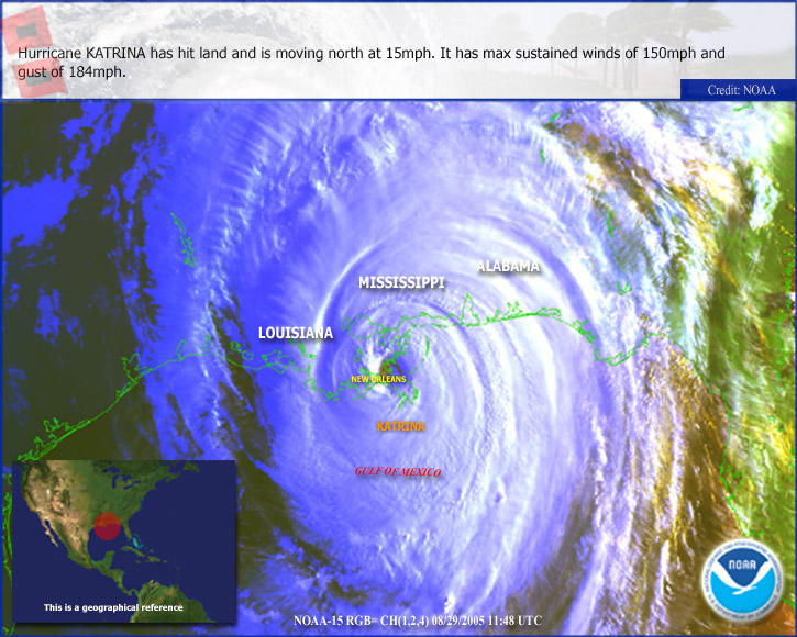
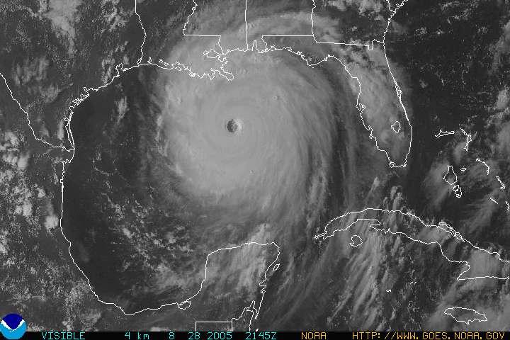
 Katrina Makes Its Way Inland
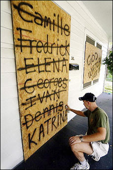 'Nuff Said
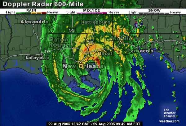
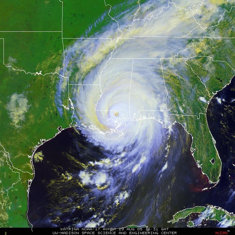
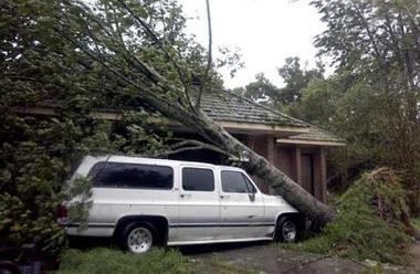 Perspective: This is 100 miles from the eye of the storm
 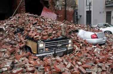 New Orleans Takes a Hit
  Blown Out Windows in Downtown New Orleans
 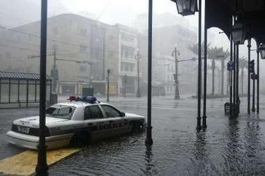 Police Cruiser Stranded on Canal Street
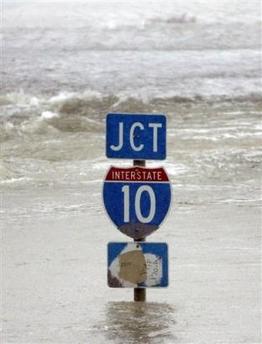 A Bit Tough To Find the Interstate
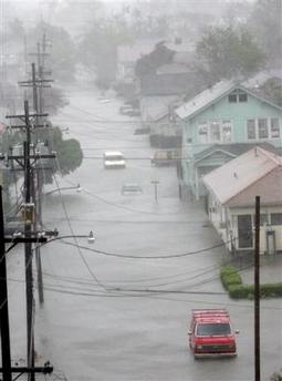 Downtown New Orleans
 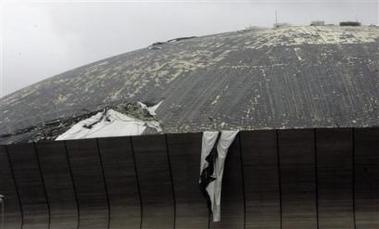 Katrina Peels Roof Off of Super Dome in New Orleans
  Taking Refuge in a Doorway on Bourbon Street
 Collapsed Building in New Orleans
 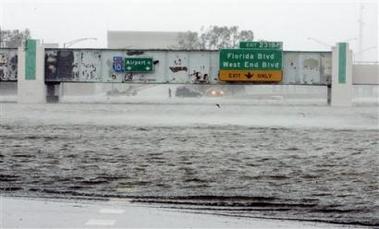 Mound Underpass, I-10, New Orleans
 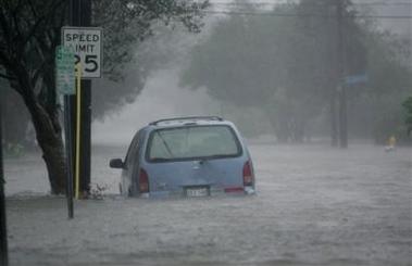 Uptown New Orleans
 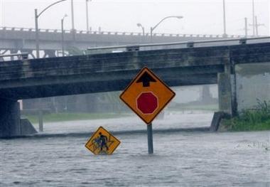 New Orleans Under Water
 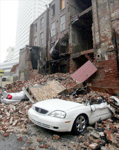 Nothing Will Be Easy in "N'awlins" For a While
 Beloved Bourbon Street in the Rain
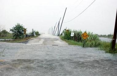 Lake Pontchartrain Floods LaCombe, LA
 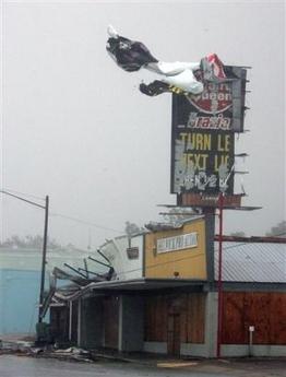 Gulfport, Mississippi
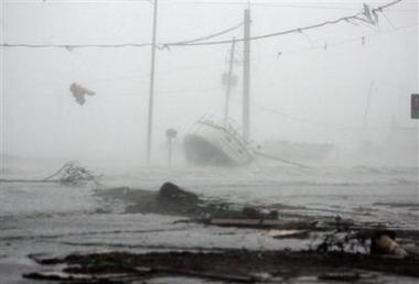 Gulfport Mississippi
 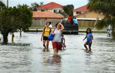 Flooding In Miami-Dade
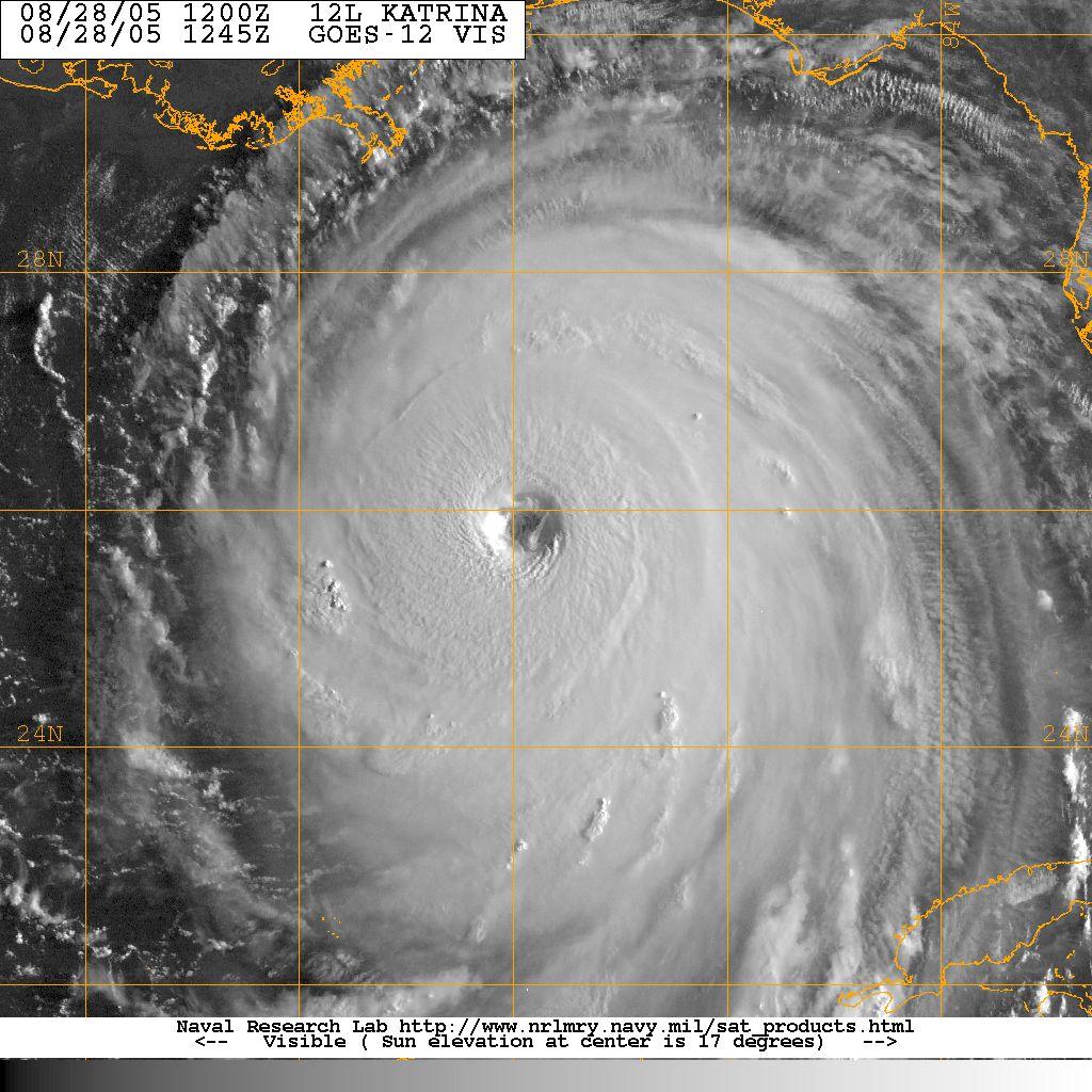
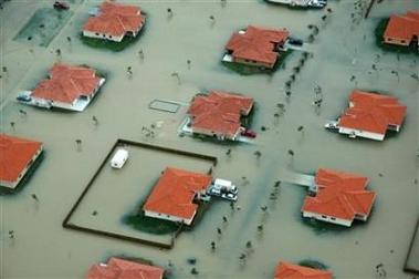 Katrina's Wrath at Category One