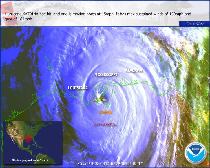
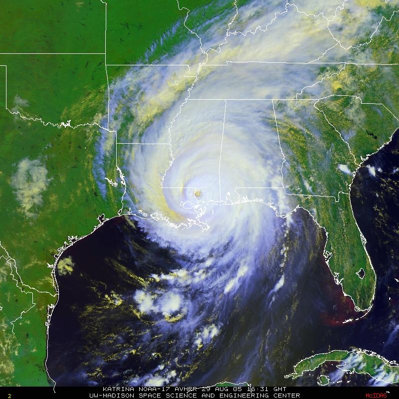
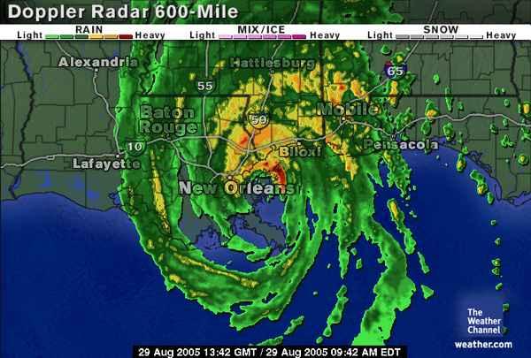
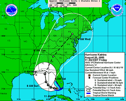
I have been quiet for the last few days in deference to the unfolding disaster along the Gulf coast. I have also been hopping mad at the government, its agencies and the pundits and talking heads on television who intellectualize and rationalize to
cover their asses. All of them fiddling while New Orleans burns and Biloxi and Gulfport wonder if anyone even knows they're alive.
But you can help.
Are you retired? Do you have the means to make it to one of the relief areas such as Houston or San Antonio? Perhaps you could volunteer to work one of the refugee facilities.
Are you a medical professional with time on your hands? Perhaps you can volunteer for the
Red Cross's relief effort.
Can you answer phones? Tear open an envelope? The
Red Cross needs volunteers for all kinds of unglamorous work that nonetheless serves the cause. Tell them you'll empty trash cans if that is what they need...every job is vital now.
Do you have little time but some extra cash? Perhaps you can make a donation to the
Red Cross. They accept everything from stocks to frequent flyer miles.
Do you live in the southeast? Do you have an extra room? Can you shelter a refugee family for a few months?
MoveOn's Hurricane Housing Effortor, if you're not fond of MoveOn:
KatrinaHome.com And last, but not least:
Pray. Pray in whatever way is appropriate to your belief system because this is the biggest, baddest thing that has ever happened to this country, including the horrific attacks on the trade centers and the Pentagon.
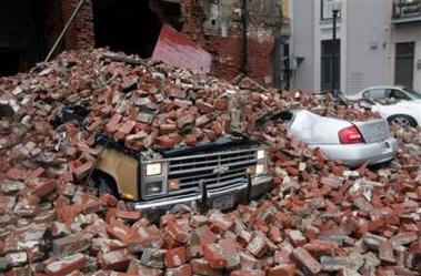
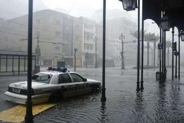
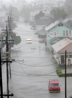
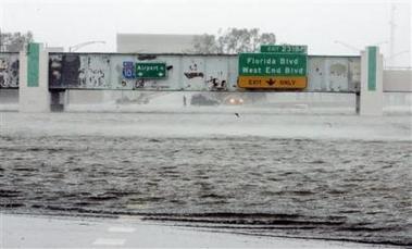
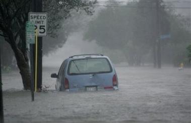
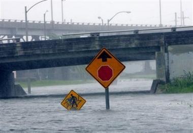
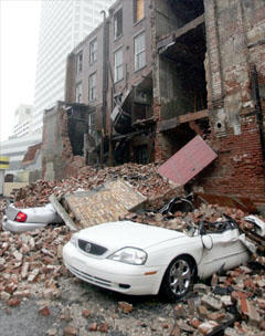
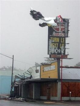
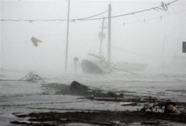
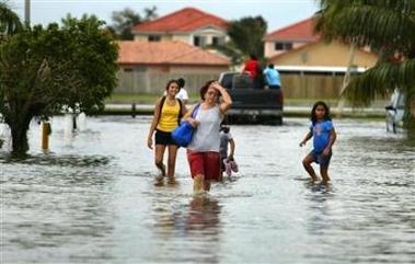
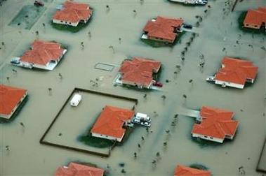
And now for the soapbox portion of the post:There is little doubt that as New Orleans, currently little more than a drowning pool for the poor and helpless, descends into anarchy that this is one of the darkest days in American history. The federal government has been torturously slow in responding to cries for help.
And where is the National Guard whose sole reason for being is to protect Americans
in America? They are, at your expense, watching in horror from Iraq. Sent to die in a senseless, unwinnable war authorized by Republicans and Democrats alike. Want to hate someone for this atrocity unfolding before us? Hate both sides, folks. Both are equally to blame. I'm not pointing fingers at only "red" or only "blue" politicians...they all suck as far as this crisis goes. The lack of action from all corners of the federal government is as staggering as the disaster.
And I don't want to hear any excuses about the magnitude of the disaster and how they need time to gather the resources to deal with it. Bullshit. They all knew this was coming. The feds, the states, everyone knew this was not an "if" situation, but a "when." So no amount of bullshit, no amount of whining, no amount of rationalization and justification from the dumb asses on Capitol Hill can erase their culpability in this tragedy. They knew. They did not act. If I performed my job like that, I would be
so fired. Think about
that in November 2006.
In the meantime, maybe we should stop listening to their lame excuses and wondering when they are going to send help. It's time the citizens, who are
truly what makes this country great, take matters into our own hands and help the poor and needy of the once great city of New Orleans and the rest of the forgotten and forsaken.
Please...open your heart, your home or your pocketbook. While the most powerful government on Earth whines about how they can't get it together enough to do their freaking
jobs, little ol' you
can do something.
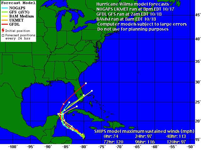
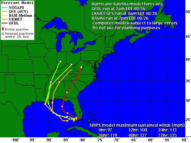
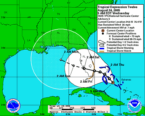
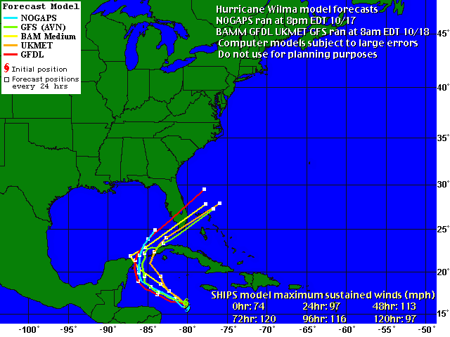 GFDL, GFS and UKMET models have been updated. You can see that the GFDL, which had tracked Wilma up to Tampa Bay, has shifted south. The NOGAPS remains on a northerly track, but it hasn't run since 10pm yesterday. The NHC insists the models are in good agreement, so we'll have to wait to see what happens as the evening progresses and NOGAPS runs again.
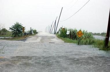
 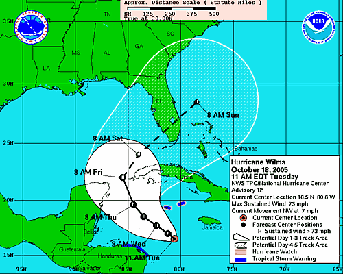 I strongly encourage everyone to keep in mind that we cannot focus on the tracks for either damage or exact landfall. We have to look at the cone and where we will be upon landfall. If you are on the Gulf Coast, you should be making preparations for both evacuating and hunkering down right now. Unless of course you enjoy getting in a fist fight with your neighbor over the last gallon of water at Winn-Dixie.