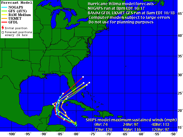
 GFDL, GFS and UKMET models have been updated. You can see that the GFDL, which had tracked Wilma up to Tampa Bay, has shifted south. The NOGAPS remains on a northerly track, but it hasn't run since 10pm yesterday. The NHC insists the models are in good agreement, so we'll have to wait to see what happens as the evening progresses and NOGAPS runs again.
 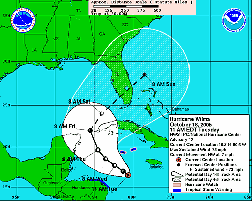 I strongly encourage everyone to keep in mind that we cannot focus on the tracks for either damage or exact landfall. We have to look at the cone and where we will be upon landfall. If you are on the Gulf Coast, you should be making preparations for both evacuating and hunkering down right now. Unless of course you enjoy getting in a fist fight with your neighbor over the last gallon of water at Winn-Dixie.
 As Wilma approaches, remember the two rules:
1. RUN from the waterI will, of course, be watching carefully and keeping the site updated.
2.HIDE from the wind.


No comments:
Post a Comment