 Ah, summer. A time for fishing, swimming, boating, beaching and watching enormous radar blobs approach the state of Florida. If you've been following the storm, you'll see the track has changed since Sunday (I couldn't write yesterday due to a small household accident that confined me to the couch) and that its prolonged journey over Cuba weakened it from a hurricane to a tropical storm. Now that it's back over water, it will restrengthen, but hopefully not much, before it makes landfall.
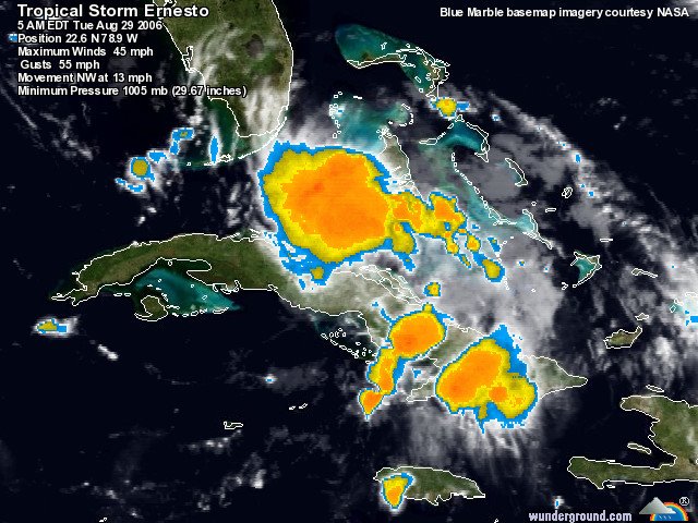
Ernesto is now forecast to smack into our neighbors in the Keys and run up the middle of the state before going back out to sea. A second US landfall somewhere in the neighborhood of the Carolinas is also forecast by the National Hurricane Center. Check out the satellite views of Ernesto to watch the center begin to form again.
Ernesto killed two people in Haiti before striking Cuba where it reportedly dropped some seven inches of rain. South Floridians still trying to recover from the 2005 season are being told to evacuate their FEMA trailers before the storm hits. The wisdom is undeniable: a trailer can't withstand the impact of even a strong tropical storm, but the irony and misery of the situation are also undeniable. The storm also forced NASA to cancel the space shuttle Atlantis launch.
And, if you can't take any more bad news, here's something from the humor files: FEMA claims it's ready for Ernesto. If that doesn't make you laugh, you haven't been paying attention.
Depending on the strength at landfall, we could get some tropical storm force winds here, so we'll be packing up the patio projectiles today. We have plenty of everything and we're as ready as possible...


No comments:
Post a Comment