To see previous landfall probabilities check out the First Day of Hurricane Season post.
2005 Forecast Forecast Activity as of: 12/03/04 04/01/05 08/05/05 Named Storms (NS) (9.6) 11 13 20 Named Storm Days (NSD) (49.1) 55 65 95 Hurricanes (H)(5.9) 6 7 10 Hurricane Days (HD)(24.5) 25 35 55 Intense Hurricanes (IH) (2.3) 3 3 6 Intense Hurricane Days (IHD)(5.0) 6 7 18 Net Tropical Cyclone Activity (NTC)(100%) 115 135 235 Check the right sidebar for a 2004 comparison and link to last year's scoreboard.
Revised Regional Probability Forecast:
Probabilities For At Least One Major (Category 3-4-5) Hurricane Landfall On Each Of The Following Coastal Areas:
1) Entire U.S. coastline - 77% (average for last century is 52%)
2) U.S. East Coast Including Peninsula Florida - 58% (average for last century is 31%)
3) Gulf Coast from the Florida Panhandle westward to Brownsville - 44% (average for last century is 30%)
4) Above-average major hurricane landfall risk in the Caribbean - revised to include Bahamas
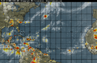
 Meanwhile, the tropics are looking eerily quiet. Tropical Depression Ten is still viable, but looks pathetic and weak spinning out there under all that shear. The NHCwarns that the storm could redevelop and advises the Northern Leeward Islands and the Virgin Islands to monitor TD 10's progress. The storm could redevelop into a tropical depression within a day or so as the low moves away into a more favorable environment for development. Even so, it looks unlikely that it will affect Florida.
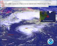
  Good NIGHT Irene. This one is the storm that just won't die. It's weakened now to a tropical storm. Irene is what is known as a "fish storm." It will stay in the ocean (good place for it if you ask me) and die at sea.
  And finally, I received this tasty picture from a subscriber this morning. A weddding cake? Or just celebrating Hurricane Frances? Seems unlikely, but hurricane mania does the strangest things to people. [Phil: Care to explain the photo?]
 NOTE: If the email is hard to read, you can access the entire post at: News From Hurricane Land. Stay tuned for more from the tropics.


No comments:
Post a Comment