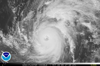
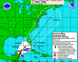
 Wilma is shaping up to be one of the nastiest storms on record. It will probably restrengthen to a category 5 before slamming into the Yucatán peninsula sometime tonight or tomorrow morning. I'm very worried about our friends in that area, but so far my attempts to contact them have failed. Hopefully, that means they are on their way away from the sea.
 We are still taking a wait-and-see attitude toward hanging the shutters because Wicked Wilma has slowed some and we can't get a good read on whether it is worth the effort or not. We do expect to experience tropical storm force winds when Wilma crosses the state due to upper level conditions that will work to pull part of the storm to the north as it crosses Florida.
The models are now shifting even farther south, but Tampa Bay is still in the cone. Remember: don't focus on the line...you have to prepare if you are anywhere inside the cone. Preparation will make all the difference to your comfort and perhaps your survival in the event of a hit.

Remember:
Run from the water.
Hide from the wind.
Please stay safe everyone.


No comments:
Post a Comment